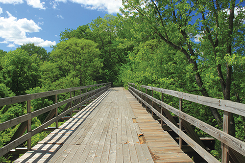
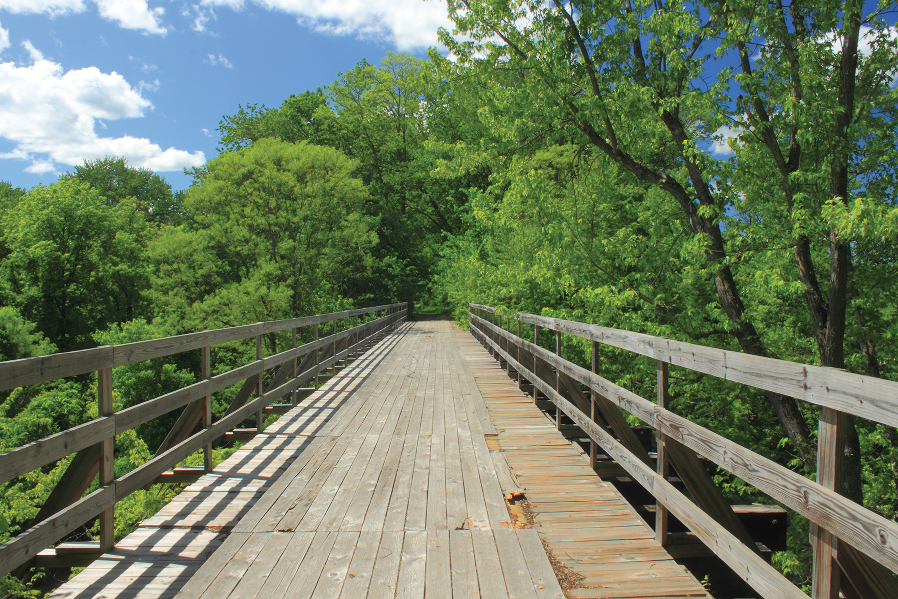
Fort Hill Rail Trail Bridge over Ashuelot River
Rail
Trails
by John Burk
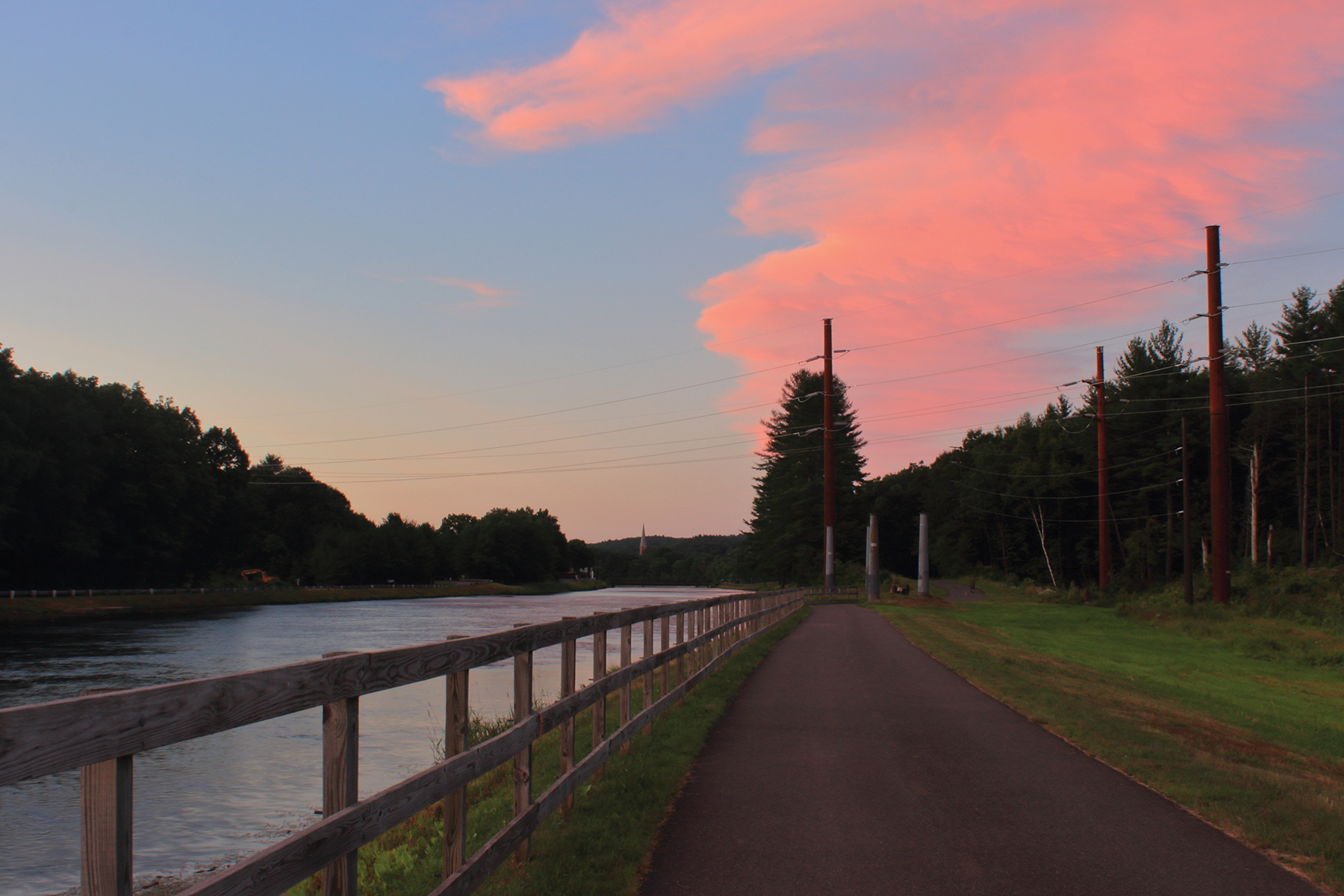
Canalside Rail Trail Turners Falls at Sunset
Diverse rail trails help preserve the central Connecticut River watershed’s rich railroad heritage. After many of the region’s railways, including the extensive Boston and Maine Railroad network, discontinued during the twentieth century, conservation and community organizations created trails on the abandoned corridors. In addition to recreational opportunities and scenic views, these routes lead to many artifacts of the lost railroads, including historic bridges, former stations, and abandoned train cars.
The Mass Central Rail Trail (MCRT) encompasses several sections of a former 104-mile railroad, established in the 1870s and owned by the Boston and Maine Railroad from 1887 to 1983, that once linked Boston and Northampton. The line provided passenger service until the 1930s, and freight trains used the western section until 1979. The popular Norwottuck Branch follows a 10-mile portion of the abandoned right-of-way between Northampton and Belchertown. At the western trailhead on Damon Road in Northampton, a 1,492-foot iron bridge, built in 1887, spans the Connecticut River, providing scenic views of Elwell Island and the Holyoke Range. After passing farm fields, Hadley’s town common, and Amherst center, the eastern section traverses several conservation areas and wetlands, including Lawrence Swamp. Other trailheads are located at Railroad Street in Hadley and Station Road in Amherst.
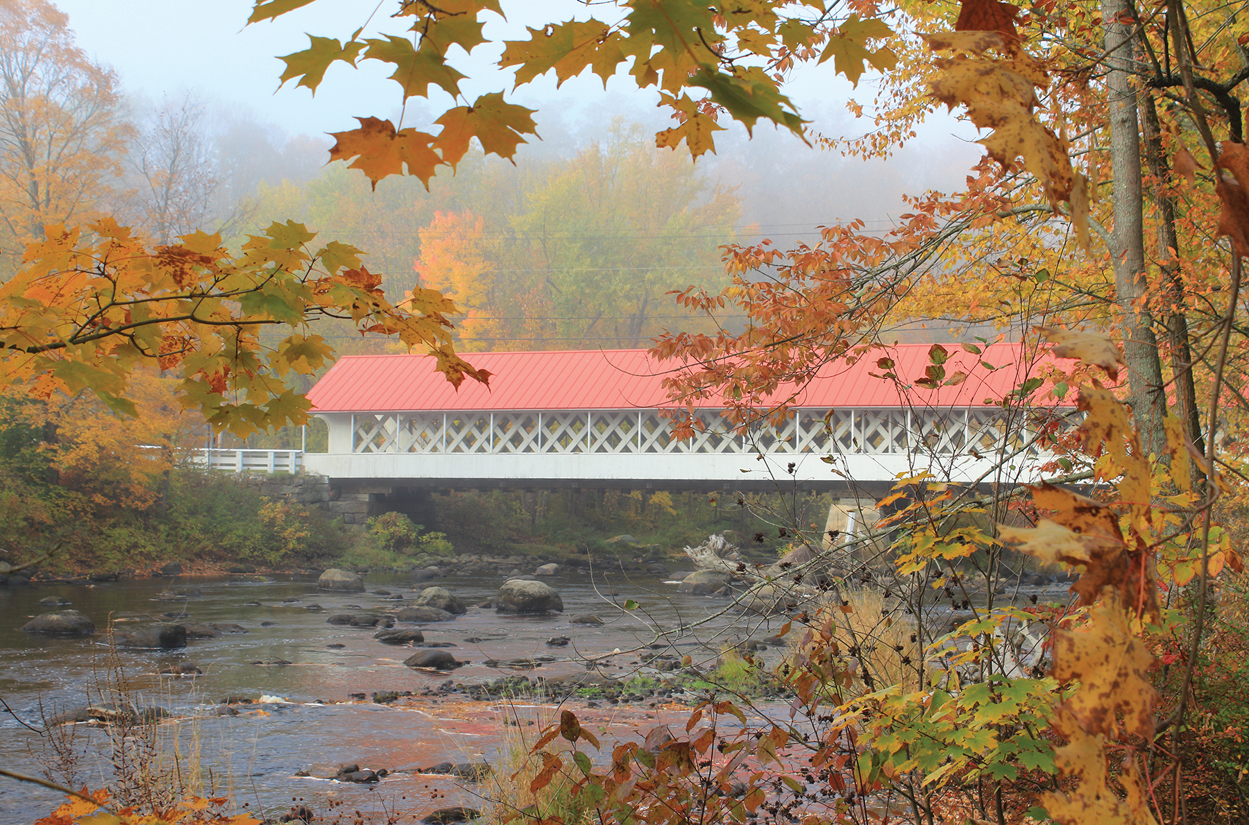
Ashuelot Covered Bridge in Autumn
A three-mile segment of the MCRT along the Ware River in Hardwick and New Braintree, managed by East Quabbin Land Trust (EQLT), features two restored truss bridges, a granite mileage marker, and views of the river and associated habitats. The trailhead, at the junction of West Road and Hardwick Road off Route 32 in New Braintree, is the site of a former depot where farmers once exported produce to Boston. EQLT also recently opened a 0.5-mile accessible stone-dust trail with interpretive signs and pollinator gardens on the former corridor at Church Street in Ware.
In the upper Westfield River valley of western Massachusetts, the Keystone Arches Trail showcases a series of distinctive stone arch bridges built during the 1840s as part of the Western Railroad, America’s first mountain railway. The line provided a crucial route across the rugged Berkshire foothills to markets in New York State and beyond. From a trailhead on Middlefield Road in Chester, the 2.4-mile footpath leads through Walnut Hill Wildlife Management Area, initially following a historical turnpike past a double arch bridge that still serves an active railway. After joining the abandoned Western Railroad line at a bridge crossing with scenic views, the route continues through a rock cut and across another bridge to the trail’s western end at the ruins of a bridge that washed out during the flood of 1927. Several interpretive signs detail the railroad and the watershed’s natural history.
The 3.6-mile Canalside Trail passes a variety of natural and cultural attractions on the Connecticut River, including a historical industrial village. From the southern trailhead on McClelland Road in Deerfield (adjacent to the East Deerfield Railroad Yard), the paved path leads past farm fields to a long trestle bridge at the confluence of the Connecticut and Deerfield rivers. The structure was built in 1880 and repaired after the great floods of March 1936, which caused substantial damage throughout the watershed. After briefly traversing town roads, the northern section parallels a historical canal past iron bridges and old mills to the Turners Falls Dam and a riverfront park at scenic Barton Cove.
Southern Vermont’s West River Railroad was often described as “36 miles of trouble” because it traversed hazardous, flood-prone terrain between Brattleboro and South Londonderry. Today several segments of the former line, originally built as a narrow-gauge railroad in 1880 and discontinued in 1936, are part of the scenic West River Trail. The 10.5-mile upper section extends from a trailhead on West River Road in South Londonderry (near a former railroad station) to Jamaica State Park. South of Winhall Brook Campground, the route follows a rougher path, best suited to foot travel, to picturesque Angel Falls and Ball Mountain Dam. In Jamaica State Park, the trail passes river views and a side path to 125-foot Hamilton Falls, one of Vermont’s largest waterfalls.
Other completed off-road segments include a three-mile route from Route 30 in East Jamaica to the Townshend Dam, and the 3.5-mile lower section, which parallels the river’s east bank from the Marina trailhead in Brattleboro to Rice Farm Road and Black Mountain in Dummerston. The West River Railroad Museum, owned by the Historical Society of Windham County, offers an extensive collection of photographs and artifacts. Located in a restored depot on Route 30 in Newfane, the museum is open weekends from Memorial Day to Columbus Day and by appointment.
In southwestern New Hampshire, the Ashuelot Recreational Rail Trail, the region’s longest contiguous rail trail at 21.5 miles, parallels a former Boston and Maine Railroad line along the Ashuelot River. From the northern trailhead in Keene, the trail leads south to the Cresson Bridge in Swanzey, one of six covered bridges in the watershed, and a trestle bridge north of Winchester. After passing a former depot in Winchester, the route bends west along the valley and passes the photogenic Ashuelot Covered Bridge, once used to transport wood across the river to supply steam engines. Other points of interest include abandoned Green Mountain Railroad boxcars, old mills, and another depot (now a private residence) with a red caboose and railroad cars on a ridge in Hinsdale. The southern section parallels Route 63 to a parking area and trailhead at Dole Junction, where the Fort Hill Recreational Rail Trail branches northwest toward Vermont.
Boston and Maine Railroad used the seven-mile Fort Hill line, part of a freight route to Canada, from 1910 to 1983. From Route 63, the unpaved rail trail follows the abandoned grade along a slope above the Connecticut River, reaching a restored wood bridge over the Ashuelot River in 1.3 miles. On the west side of Hinsdale center, a long causeway offers open views of the Connecticut River, including the former Vermont Yankee nuclear power plant. Access is available from parking lots off Route 119. At the trail’s north end, a large truss bridge, built in 1912, spans the crossing to Brattleboro, Vermont. The structure is currently unmaintained and unsafe for public access.

Two rare covered railroad bridges are the main attractions of the 9.5-mile Sugar River Trail, located in Newport and Claremont, New Hampshire. Only eight of these distinctive structures, distinguished from covered road bridges by high portals, remain in the United States. Boston and Maine Railroad acquired the original Sugar River Railroad in 1887 and built the covered bridges in the early twentieth century. Pier Bridge spans a crossing roughly 5.5 miles west of Newport, and Wright’s Bridge is 1.2 miles further west. Both covered bridges can be directly accessed from Chandler Road, which parallels the south side of the river in the Kellyville section of Newport. The scenic trail also features five other river crossings.
The Rails-to-Trails Conservancy, a non-profit organization dedicated to establishing rail trails and connecting communities, offers guidebooks to rail trails in northern and southern New England, and a comprehensive multi-use trail listing. To learn more, visit railstotrails.org.
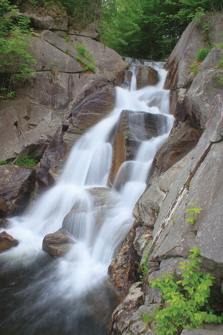
Angel Falls West River Trail